
Chair’s Address
Mr Michael Burdett, Surveyor–General of South Australia
This is a period of some significance as ICSM reaches milestones in key projects. With the formal release of Cadastre 2034 at Locate 15 in Brisbane, the Permanent Committee on the Cadastre has commenced aligning its future work plan to actions set out in the strategy. The roll out of ePlan is continuing to gain momentum on the eastern seaboard with other states all keen to participate. This area has proved to be one where strong engagement between ICSM members and the profession is of critical importance.
The Permanent Committee on Geodesy is now compiling the datasets for the national adjustment and is turning its mind to the establishment of a new working group to oversee the communication and implementation of the Datum Modernisation Project. This work has implications well beyond the spatial profession and is of truly national importance.
ANZLIC’s Foundation Spatial Data Framework initiative is now underway and all parts of ICSM are working towards achieving the goals set out in the ten roadmaps. Geoscience Australia is playing a pivotal role in this work by developing tools to assist in the project management and identification of actions, outcomes and benefits of the FSDF work.
This is just a snapshot of the areas in which ICSM are working to support the spatial profession and the community at large.
Committee Members
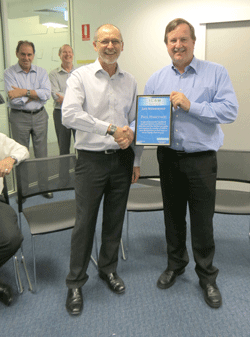
Mr Paul Harcombe completed his term as Deputy Chair on 30th June 2015. Mr Michael Giudici, Surveyor General of Tasmania was elected unopposed at the May 2015 ICSM meeting in Darwin as the incoming Deputy Chair, and Chair-elect 2016-2018 .
National Strategy for Cadastre Released
A future where anyone can easily tell what can be done on land, what cannot be done and what must be done is the vision of the recently released national strategy on cadastre.
Launched at Locate 15 in Brisbane, CADASTRE 2034 – Powering Land & Real Property is a national strategy for cadastral reform and innovation in Australia.
Developed by ICSM, the strategy recognises that current cadastral systems do not adequately identify the location and extent of all rights, restrictions and responsibilities related to land and property.
Responding to community expectations that such information be readily available, the primary focus of the strategy is the incorporation of these rights, responsibilities and restrictions into cadastral systems. This includes embracing the use of 3 and 4 dimensional capabilities to represent property both above and below the ground, reflecting the inherent complexity of today’s urban landscape.
The strategy does not call for immediate and quantum shifts in existing practices, acknowledging Australia’s world class cadastral systems, and upholding the deeply borne expectation that our cadastres provide ongoing certainty of ownership within appropriate regulatory frameworks.
The strategy is the result of an extended consultation process involving government, industry and the community. Michael Burdett expressed his thanks to all of the individuals, organisations and businesses who took part in the consultation and provided their experience, visions and ideas for the future. “Without these contributions we simply would not have been able to develop a strategy that targets the right issues,” he said.
Modernising Australia’s geocentric datum
The Geocentric Datum of Australia 1994 (GDA94) paved the way for future improvements to the national datum by bringing it into close alignment with the globally standardised International Terrestrial Reference Frame (ITRF). The current paradigm shift towards ubiquitous positioning is driving the requirement to again modernise the national datum – so Australia can maximise the societal and economic benefits offered by this new paradigm.
The Permanent Committee on Geodesy (PCG) met in Canberra in February 2015 to consider and revise its Datum Modernisation Roadmap. The roadmap proposes an incremental, two stage implementation of a two–frame concept in which both a conventional datum and a reference frame will be simultaneously supported.
The Stage—1 implementation has been given a working title of Geocentric Datum of Australia 2020 (GDA2020) while Stage—2 has a working title of the Australian Terrestrial Reference Frame (ATRF).
PCG is currently preparing the documentation for ICSM to seek approval by ANZLIC at their July 2015 meeting for the proposed datum modernisation and its implementation timeframe. This documentation will recommend formal release of all resources required for Stage—1 of the modernised Australian datum by January 1, 2017.
Stage—1 proposes a new, more complete and rigorous national adjustment of the geodetic network and the coordinates projected to a reference date of 1 January 2020. Horizontal coordinates will shift by approximately 1.8 metres which better aligns with ITRF. This relatively small change will mean that any difference between ITRF and the new datum will be small enough to be ignored for most users.
In Stage—2, with an implementation commencement of 1 January 2020, it is proposed to transition to a reference frame, the ATRF, that will be time dependent and highly accurate with respect to the ITRF. Importantly, GDA2020 (or its successor) would also be retained in perpetuity, unless it became obvious that a static datum was no longer needed.
PCG has drafted Statement on Datum Modernisation – version 25 March 2015 which outlines the background to GDA94 modernisation, provides a brief synopsis of the drivers for change and describes the new two–frame proposal in more detail. A report on Stakeholder Requirements for Modernising Australia’s Geocentric Datum is also now available.
The Tidal Realm Model
In early May 2015, the ICSM – Permanent Committee on Tides and Mean Sea Level (PCTMSL) handed over documentation for the Tidal Realm Model to ANZLIC to become part of Foundation Spatial Data Framework Elevation and Depth theme. This has been a significant achievement and is the culmination of considerable work by members of the PCTMSL over a number of years.
Before the Tidal Realm Model was introduced, users would have to develop individual programs to convert the multitudes of formats as input to their database and or programs prior to using the data, proving tedious and very inefficient.
The aim of the Tidal Realm Model is to provide a common reference for onshore and offshore elevation of Australia and New Zealand. Accurate spatial data for the coastal (littoral) zone is important for many environmental, societal and economic reasons including community safety, maritime safety, infrastructure management and management of the coastline. This will allow the end user to access data from multiple sources using one single format type, which will make combining spatial information seamless, efficient and user friendly.
The model complies with ISO standards and informs the International Hydrographic Organization S–100 Universal Hydrographic Data Model series. S–100 provides the structural support to implement the model and allows for multiple uses of tidal information other than navigational charts. The Tidal Realm Model is also aligned to the work being done by Infrastructure for Spatial Information for the European Community.
The Tidal Realm Model will provide common transfer structure and definitions for the following products such as Tide Gauge Metadata – (this section contains the information that links ocean and land datasets), Tidal height (observations and predictions) and Tidal Constituents Readings.
It is intended for the model to be further developed to include other data such as Tidal Interface, Tidal Streams (Eulerian and Lagrangian), Tidal Stream Atlas and Tidal Datum Surfaces.
The introduction of the model has provided a significant leap in capability for the end user. The model has place holders for future development to support the creation of specifications to support Dynamic Tides and will continue to be utilised in the development of tidal surfaces.
Zarina Jayaswal
Deputy Director of Tides and Geodetic Control
Australian Hydrographic Office
Next ICSM meeting
The next meeting will be held in Hobart, Tasmania on 21 & 22 October, 2015.
Previous news letters
- December 2014
- December 2013
- August 2013
- October 2012 (.pdf file, 1.9 MB)
- February 2012 (.pdf file, 3.5 MB)
- June 2011 (.pdf file, 2.9 MB)
- December 2010 (.pdf file, 2.4 MB)
- June 2010 (.pdf file, 3.1 MB)
- December 2009 (.pdf file, 5.1 MB)
- June 2009 (.pdf file, 5.1 MB)
- December 2008 (.pdf file, 2.1 MB)
- June 2008 (.pdf file, 1.0 MB)
- December 2007 (.pdf file, 0.7 MB)
- June 2007 (.pdf file, 0.8 MB)
- December 2006 (1.7 MB)
- June 2006 (.pdf file, 1.2 MB)
- December 2005 (2.5 MB)
- June 2005 (.pdf file, 1.5 MB)
- 2004 (0.7 MB)
- December 2003 (.pdf file, 1.1 MB)
- June 2003 (.pdf file, 91.0 MB)
- November 2002 (.pdf file, 0.7 MB)
- June 2002 (.pdf file, 0.7 MB)
- November 2001 (.pdf file, 0.5 MB)
- May 2001 (.pdf file, 0.4 MB)
- June 2000 (.pdf file, 2.1 MB)